
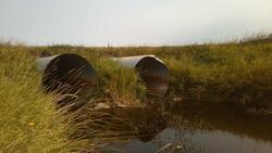
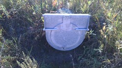
The EIWD has been working with the Province of Manitoba and the International Water Institute (IWI) to develop tools utilizing LiDAR (Light Detection and Ranging), a highly accurate elevation model collected from a plane using lasers. These tools help prioritize conservation project locations and assist in water management.
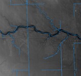
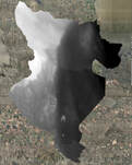
LiDAR was collected in the Icelandic River/Washow Bay watershed in 2011. The EIWD has worked with our project partners to analyze this data to help provide watershed residents, resource professionals, and local, provincial and regional official’s relevant land and water information.
LiDAR was collected in the Icelandic River/Washow Bay watershed in 2011. The EIWD has worked with our project partners to analyze this data to help provide watershed residents, resource professionals, and local, provincial and regional official’s relevant land and water information.
